

 Angelica & Matt Norton
1 min read
3D Printing of Living Walls
A team of researchers from the University of Virginia (UVA) discovered a way to create soil structures with the help of 3D printing. The technology...
In our previous article, we discussed the significance of precision in-site documentation during the design phase and its potential to bolster a designer's business. However, one persisting issue within the field of landscape architecture is the disconnect between design concepts and construction constraints. To address this, we built a comprehensive design and construction firm under one roof, focusing on the pivotal ratio of impact to effort in design. Our shift toward primarily using 3D design has proven instrumental in creating designs that blend impactful concepts with practical solutions.
Traditional 2D design methods necessitate designers to possess a three-dimensional mental grasp of their ideas, a skill that requires time to develop. Moreover, clients often struggle to interpret 2D representations, leading to misunderstandings and unrealistic expectations. Transitioning to 3D design has not only aligned our visions with clients' expectations, but has also made it significantly easier to convey our concepts.
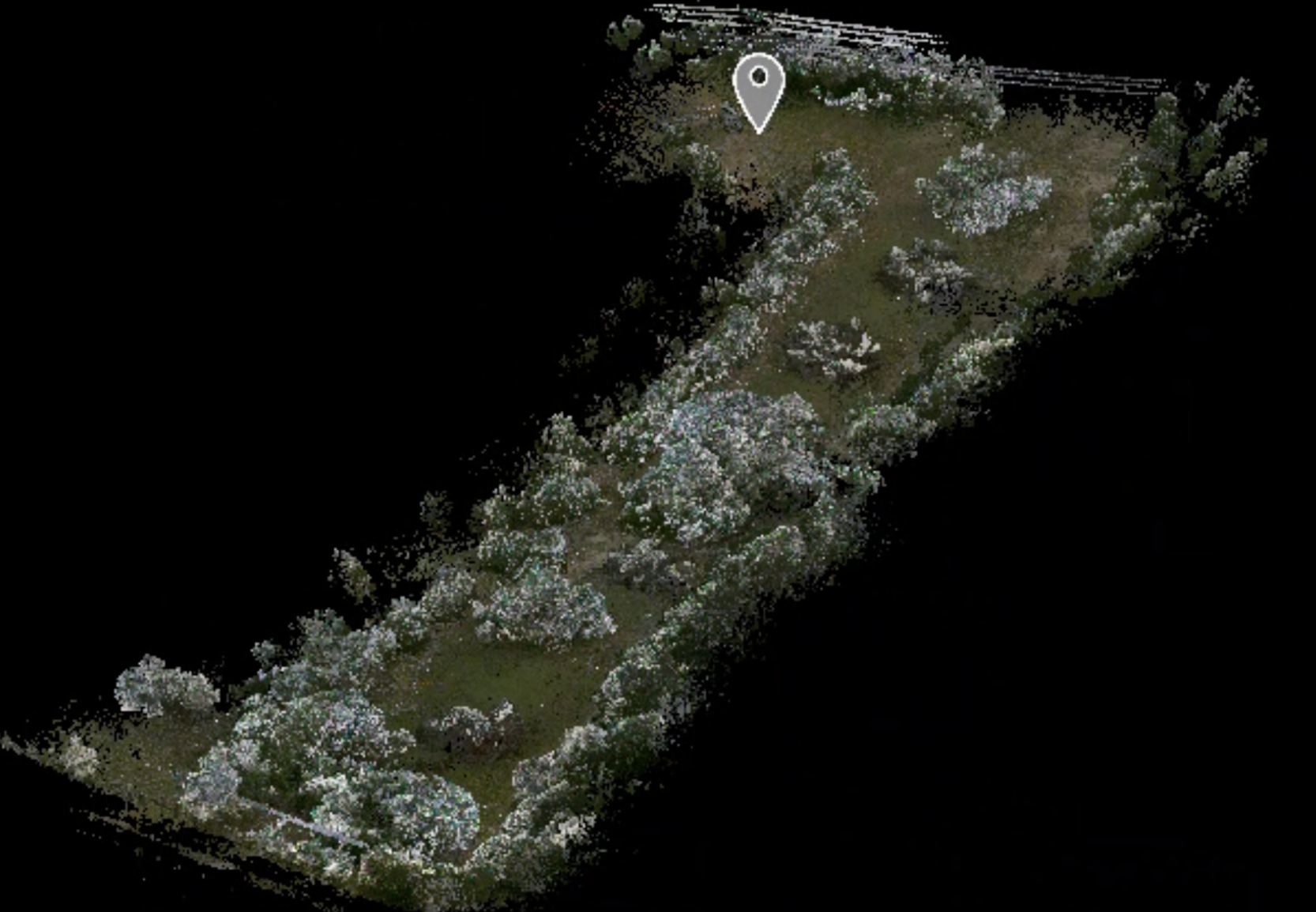
Numerous 3D modeling software options are available, each with its own strengths. We have predominantly utilized SketchUp due to its user-friendly nature and widespread familiarity among project managers, tradespeople and clients. Initially, we used SketchUp as a tool for brainstorming and conveying design ideas. However, as we grew more proficient, we began harnessing its capacity to import and export valuable digital data. The model itself serves as a resource for generating counts for project estimation as well as predict accurate solar paths for shade studies. Our latest advancement involves importing data into the model from a LiDAR scanner.
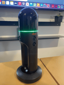 LiDAR technology, once financially out of reach for smaller businesses, has become an essential design tool. Our interest was sparked by the rudimentary LiDAR capabilities of the iPhone. After extensive research, we adopted the Leica BLK 2 GO for its accuracy, portability and user-friendliness. Unlike conventional stationary LiDAR systems that require multiple scans and stitching together with software, the BLK 2 GO scans while the user walks the site, revolutionizing our base map creation process. We can now scan an entire site within 30-60 minutes, providing a digital twin for measurements and model creation. This reference is invaluable for site condition assessments of complex shapes or verifying critical as-built components. While our adoption of 3D modeling and LiDAR technology has vastly improved our design output, we've also encountered an unexpected challenge: the risk of design concepts becoming homogeneous and sterile. In our next article, we will delve into the importance of emotional experience in design and its often overlooked role in the value of space-making.
Angelica Norton, ASLA
Owner & Principal Designer of
Open Envelope Studio LLC
Phone: (512) 925-0155
Email: angelica@openenvelopestudio.com
1 min read
A team of researchers from the University of Virginia (UVA) discovered a way to create soil structures with the help of 3D printing. The technology...

1 min read
Lori Hawkins Explains How You Can Rise Above the Competition with 3D Design
.png)
1 min read
Project Details Build Time: projected 18 months | Size of Project: approximately 20 acres (within an existing 209-acre park) | Project Value: $27...