 Angelica & Matt Norton

1 min read
Part II
Building a Base: Good design begins
with an accurate base map
In our last article, we talked about consultations. Let’s assume you got the job—what’s next? Every landscape design starts with making a base map. A base map is similar to a survey, but it documents changes in grade, existing plants, relevant architecture, property lines and a slew of other site conditions and constraints. There is real pressure to cut corners at this stage, because clients often voice their preference that billable time is spent toward the design. But we’re firm believers that an accurate and detailed base map is worth the investment and the effort, because it will both help your business grow and make jobs more efficient.
When we started out, we utilized surveys, hand-measurements and photos to piece together a crude representation of the site. Our goal was to get to the build phase as soon as possible and the only drawing we produced was a 2D plan to scale. (We occasionally produced 3D vignettes in Sketchup.) The lack of specificity of our designs required daily site visits to react to the realities of slope, trees, drainage and gaps in documentation. This worked for a few years because our projects were small and simple, and our low volume of work allowed us to make site visits to provide guidance. As time passed, we generated a long backlog because our current method did not allow for very many jobs at once.
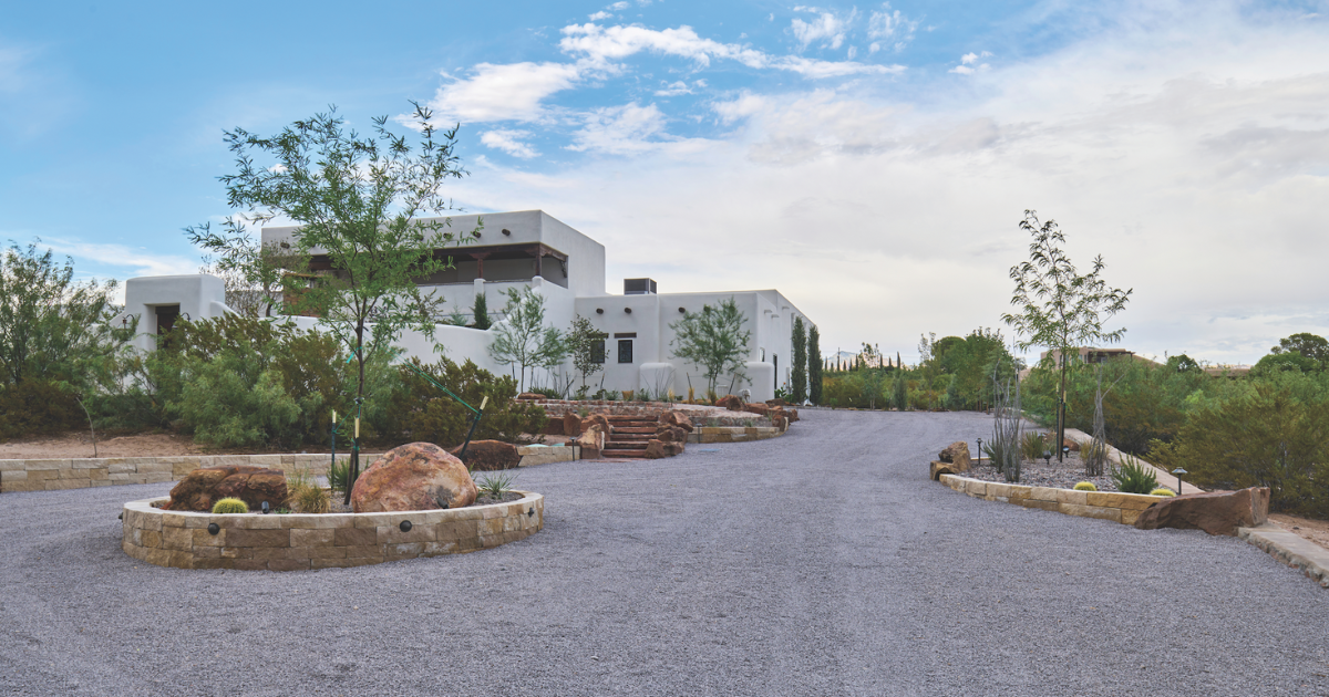
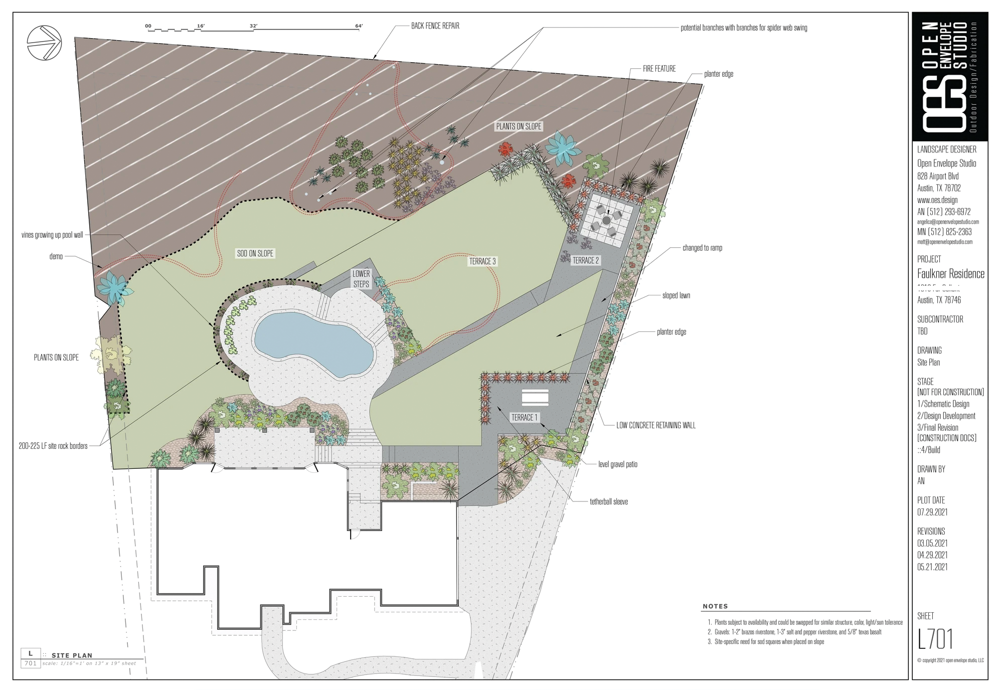 OES Faulkner Residence
We soon realized that if we created more detailed drawings, the need for site visits could be drastically reduced. To do this, we needed a highly detailed representation of the site from which to design. At that point, we began to explore solutions from the construction industry like transits, zip levels and rotary lasers. We identified that certain measurements were critical to a design on every project, like tree flares and door thresholds, and these tools were great with accurately measuring these key points. We saw a huge leap in job efficiency because we avoided the common scenario of stalled contractors awaiting designer’s guidance on unanticipated site conditions. Clients also appreciated smoother projects with fewer change orders and uncertainties. Fine-tuning this process generated business growth, and we found ourselves taking on projects of greater complexity and size.
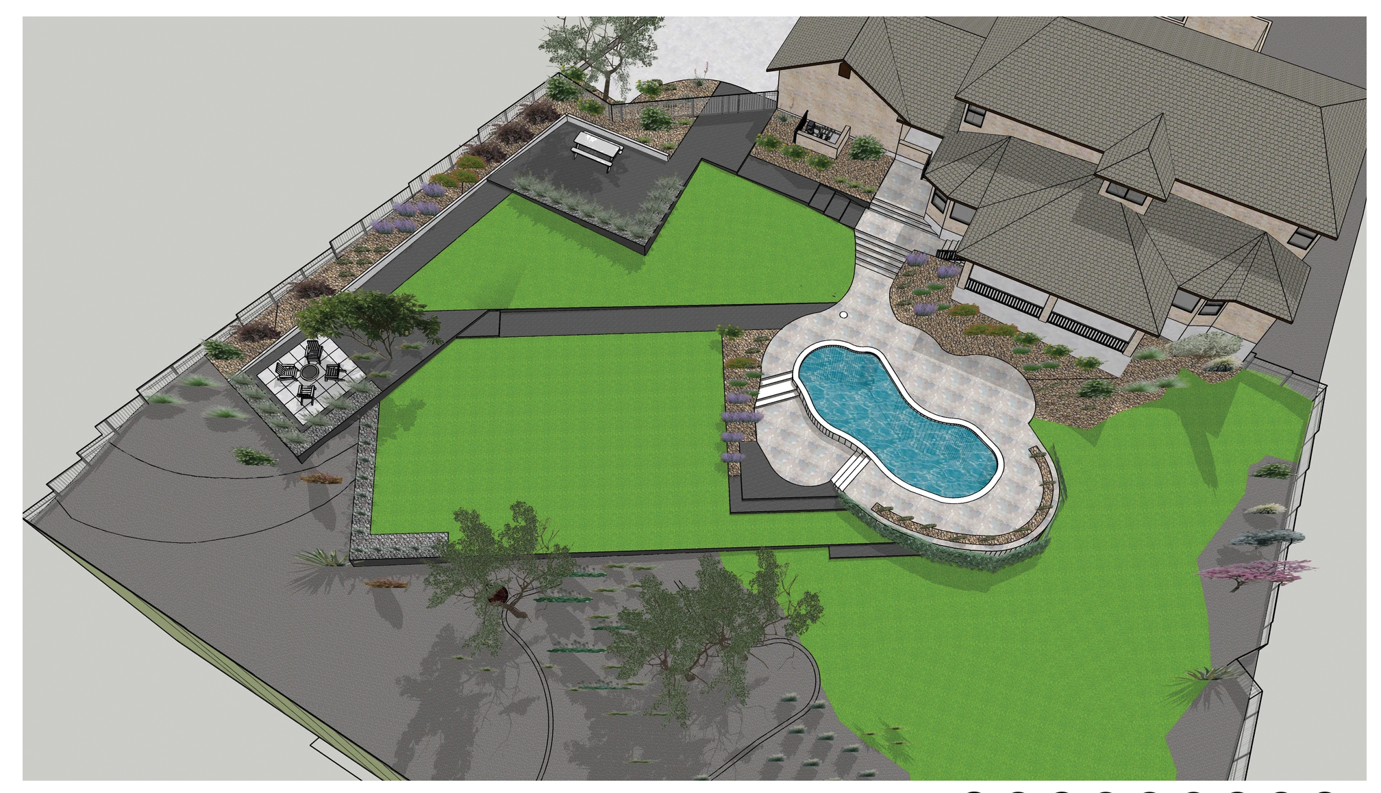 OES Faulkner Residence 3D Rendering
Collecting and documenting accurate and detailed information has played a large role in our firm’s success. At this moment, we find ourselves undertaking our most challenging projects to date. We’ve been looking toward emerging technologies to streamline both the process of collecting data and conveying design ideas to clients, which we’ll talk about in our next article.
Get In Touch With...
Angelica Norton, ASLA
Owner, Principal Designer of Open Envelope Studio, LLC
Main (512) 925-0155
Email: angelica@openenvelopestudio.com
www.oes.design
.png)
1 min read
Steel in the Landscape
Angelica & Matt Norton, landscape designers & owners of Open Envelope Studio, discuss applications, installation, and aesthetic opportunities of...